Melbourne’s real estate market has always been fiercely competitive. In this environment, property sellers and agents are constantly seeking innovative ways to stand out from the crowd.
Aerial photography has emerged as a game-changing tool for showcasing properties. What was once reserved for luxury estates is now becoming standard practice across all market segments.
This shift is transforming how buyers discover, evaluate, and connect with properties. Let’s explore how drone technology is reshaping Melbourne’s real estate landscape.
The Rise of Aerial Imagery in Property Marketing
Traditional ground-level photography can only tell part of a property’s story. Aerial shots reveal the complete picture that buyers need to make informed decisions.
Melbourne’s diverse neighbourhoods each have unique characteristics best captured from above. From bayside suburbs to leafy eastern enclaves, aerial perspectives showcase what makes each location special.
The technology has become increasingly accessible and affordable in recent years. This democratization means properties at every price point can benefit from stunning aerial imagery.
Why Aerial Photography Works for Real Estate
Buyers today begin their property search online long before attending inspections. High-quality aerial images capture attention in crowded digital listings.
Properties with aerial photography receive significantly more engagement than those without. Studies suggest listings with drone imagery generate up to 68% more buyer interest.
The bird’s-eye perspective creates an emotional connection with potential buyers. They can envision themselves living in the space and enjoying the surrounding area.
Showcasing Property Boundaries and Land Size
Melbourne blocks vary enormously in size and shape. Ground-level photos often fail to communicate the true scale of a property.
Aerial photography clearly defines boundary lines and lot dimensions. Buyers immediately understand exactly what they’re purchasing without guesswork.
This clarity is particularly valuable for properties with irregular shapes or large land parcels. Acreage properties and development sites benefit tremendously from overhead perspectives.
Highlighting Location Advantages
A property’s proximity to amenities significantly impacts its value. Aerial shots can capture nearby parks, schools, shopping centres, and transport links in a single frame.
Melbourne buyers prioritize lifestyle factors when choosing a home. Showing the beach, CBD skyline, or local parklands from above reinforces location benefits.
Professional drone photography Melbourne services understand how to frame these locational advantages effectively. They know which angles best showcase each suburb’s unique selling points.
Capturing Outdoor Living Spaces
Melbourne’s climate encourages outdoor living and entertaining. Aerial photography brilliantly showcases gardens, pools, and alfresco areas.
Ground-level shots often struggle to convey the flow between indoor and outdoor spaces. Drone imagery reveals how these areas connect and complement each other.
Landscaping investments become immediately apparent from above. Mature gardens, tennis courts, and outdoor kitchens command the attention they deserve.
Neighbourhood Context Matters
Buyers don’t just purchase a house; they buy into a neighbourhood. Aerial photography places the property within its broader community context.
Tree-lined streets, nearby reserves, and neighbourhood character become visible from above. These elements strongly influence buyer perception and property value.
Melbourne’s distinct pockets each have their own appeal. Aerial imagery helps buyers understand and appreciate what makes each area unique.
The Competitive Edge for Agents
Real estate agents face intense competition for listings. Offering aerial photography as part of a marketing package differentiates top performers.
Vendors increasingly expect comprehensive visual marketing for their properties. Agents who deliver drone imagery demonstrate commitment to achieving the best result.
This technology has become a powerful listing presentation tool. Agents showcasing aerial capabilities often win more listings than those relying on traditional methods.
Commercial and Development Applications
Aerial photography isn’t limited to residential sales. Commercial properties and development sites benefit enormously from overhead perspectives.
Investors evaluating commercial opportunities need to understand the site context and potential. Aerial imagery provides crucial information that ground-level photos cannot convey.
Development site marketing relies heavily on showing land potential. Drone footage helps buyers visualize future possibilities and assess feasibility.
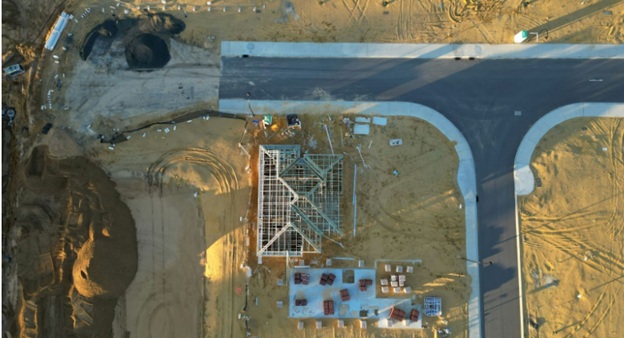
Before and After Construction Documentation
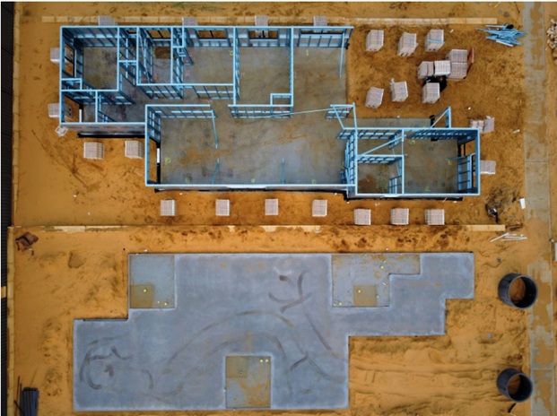
Builders and developers use aerial photography to document project progress. Regular drone flyovers create compelling visual records of construction milestones.
This documentation serves marketing and compliance purposes simultaneously. Completed project galleries showcase the transformation from vacant land to finished development.
Off-the-plan buyers gain confidence seeing construction progress through aerial updates. This transparency builds trust and reduces settlement anxiety.
Video Tours Take Engagement Further
Static aerial images are powerful, but drone video elevates marketing further. Cinematic property flyovers create immersive experiences for remote buyers.
Melbourne attracts significant interstate and international buyer interest. Video tours allow distant purchasers to thoroughly evaluate properties before travelling for inspections.
Social media platforms favour video content in their algorithms. Aerial property videos generate exceptional engagement and sharing across digital channels.
Seasonal and Golden Hour Advantages
Timing dramatically affects aerial photography results. Professional operators understand Melbourne’s best conditions for stunning imagery.
Golden hour flights capture warm, inviting tones that resonate with buyers. Seasonal considerations ensure properties are photographed at their absolute best.
Autumn foliage, spring blossoms, and summer blue skies each create different moods. Strategic timing aligns imagery with target buyer preferences and property strengths.
Regulatory Compliance and Safety
Drone operations in Melbourne must comply with Civil Aviation Safety Authority regulations. Professional operators maintain proper licensing and insurance coverage.
Many Melbourne suburbs have specific flight restrictions near airports and populated areas. Experienced pilots navigate these requirements safely and legally.
Hiring qualified professionals protects agents and vendors from liability concerns. Compliance demonstrates professionalism and attention to detail.
Cost-Effectiveness for Sellers
Aerial photography costs have decreased substantially as technology has matured. The investment typically pays for itself through faster sales and better prices.
Compared to overall marketing budgets, drone imagery represents excellent value. The impact on buyer engagement far exceeds the modest additional expense.
Vendors increasingly view aerial photography as essential rather than optional. Smart sellers recognize the competitive disadvantage of listing without it.
The Future of Property Marketing
Emerging technologies continue to expand aerial photography capabilities. Virtual reality integrations and 3D mapping are becoming increasingly common.
Melbourne’s real estate industry embraces innovation readily. Early adopters of new visual technologies consistently outperform competitors.
Buyer expectations will only increase as technology advances. Properties marketed without aerial imagery may soon appear outdated by comparison.
Making the Investment
Sellers considering aerial photography should partner with experienced local operators. Melbourne-specific knowledge ensures optimal results for each unique property.
Quality varies significantly across providers in the market. Reviewing portfolios and client testimonials helps identify the right fit.
The best results come from operators who understand both aviation and real estate. This dual expertise translates into imagery that genuinely sells properties.
Conclusion
Aerial photography has fundamentally changed Melbourne’s real estate marketing landscape. Properties showcased from above connect with buyers more effectively than ever before.
The technology offers benefits for vendors, agents, and buyers alike. Everyone gains from clearer, more comprehensive property presentations.
As competition intensifies, aerial imagery becomes increasingly essential for success. Those who embrace this transformation position themselves for better outcomes.
Melbourne’s property market rewards innovation and quality presentation. Aerial photography delivers both, making it an indispensable tool for modern real estate marketing.