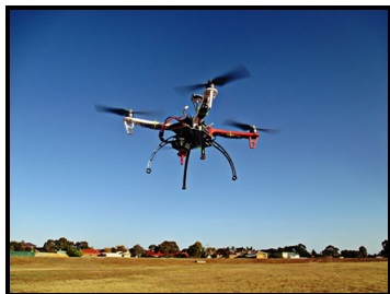
Rural Karnataka will now see drones taking over its skies to help assess the quality of over 20,000 km of roads if everything falls in place.
Drones are being seriously considered by the government of Karnataka to come up with a Road Condition Index. These drones will help to identify lands that need repair under the “Grameen Sumarga” project. Under this project, a budget of Rs 7,182 crores is decided to upkeep the rural roads.
According to Rural Development and Panchayat Raj (RDPR) Minister, Krishna Byre Gowda, the government is also searching for vehicles that will be fitted with sensors which will help in scanning the roads. This will be the 1st part of the decision-making process, while the 2nd part will include the footages taken from the drones.
With the advent of technology the quality of roads will now be assessed on a realtime basis and is expected to be more accurate. Earlier, the condition of the road was measured visually or manually which did not yield accurate results. The government was under the doubt whether the officials even visited the spot for inspection.
Karnataka has a rural blacktop road network of 56,362 km. Of them, authorities have identified 24,246 km as priority village roads that provide access to key infrastructures like schools, hospitals, offices, and markets. Of these, 4,000 km of roads are in good condition while the remaining 20,000 km need reconstruction, re-asphalting, and other repairs.
RDPR principal secretary, L K Atheeq, explained that the drones will continuously record the video of the road over which it has been flying. The software will analyse the video real-time based on the parameters, which will, in turn, result in an index for each road. The parameters for the Road Condition Index is based on potholes, edge breaks, ruts/depressions, cracks, pavement failure and so on
Mangaluru-based company Quad Perspective helped the RDPR department to understand the feasibility of a drone-based survey. The former company has used the dromes to help in the rehabilitation process in the Kodagu district after the massacre created by the floods. As per Atheeq, “Bid documents are being finalised to float a tender for the survey.”
The Road Priority Index will help the Road Condition Index in the finding stretches of roads that are of utmost importance.
Quad Perspective co-founder, Anuj Mascarenhas, believes that drones are the future of surveillance due to their photogrammetry. Hence drones are rapidly finding a place in governance.
Karnataka has already announced a drone-based revenue survey of five districts and Bengaluru city in partnership with the Survey of India. The Karnataka Knowledge Commission has pushed for the use of Unmanned Aerial Vehicles (UAV) in agriculture, forest, mining, homeland security, archaeology, disaster management, urban growth monitoring among other areas.


